The plan called for six inches of topsoil. We keep finding clay.
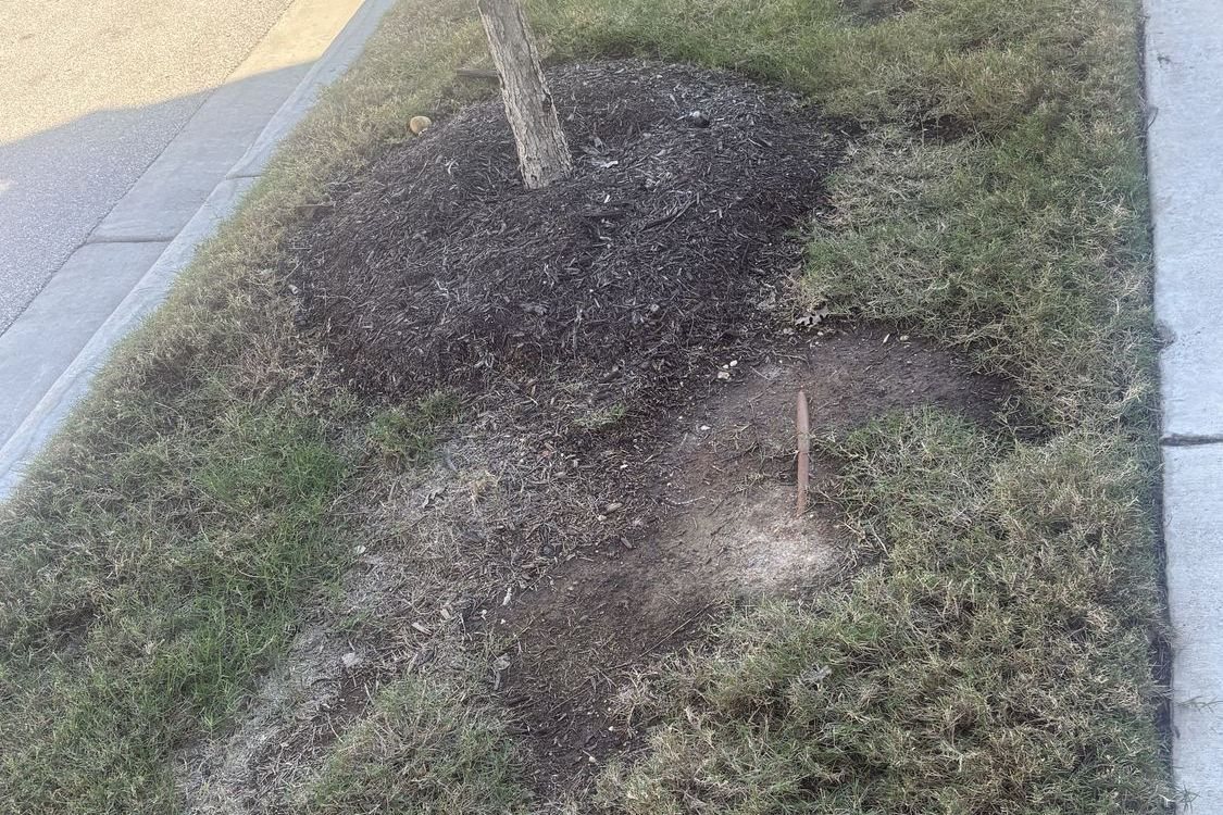
On several streets in Mueller, the grass between the sidewalk and the curb is thin, bare or dead. Where the ground is open, the sod and the drip line sit right on clay. We're neighbors asking the City to come and inspect it.
- –reports on the map
- –blocks or areas with a report
- –reports from homeowners
- –petition signatures
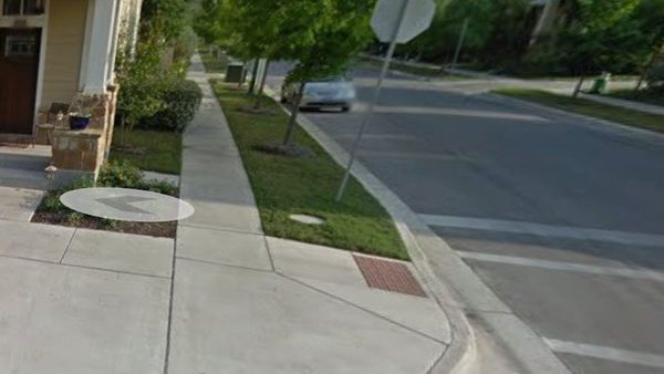
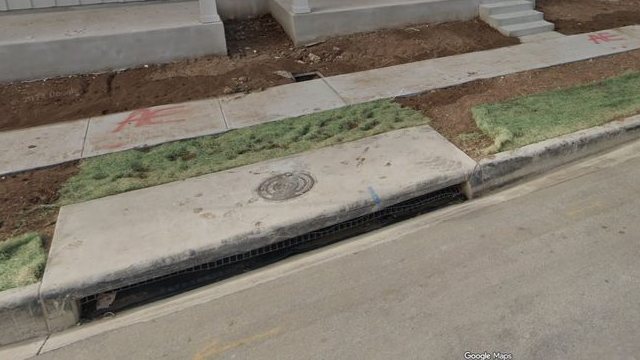
Zach Scott St, 2013 and 2026
Corner in the 2100 block
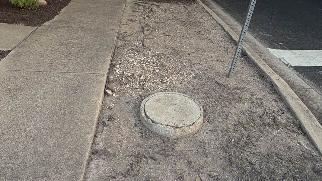
2200 block, at Threadgill St
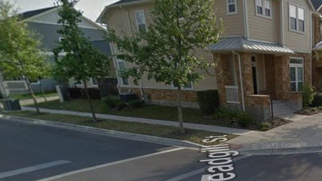
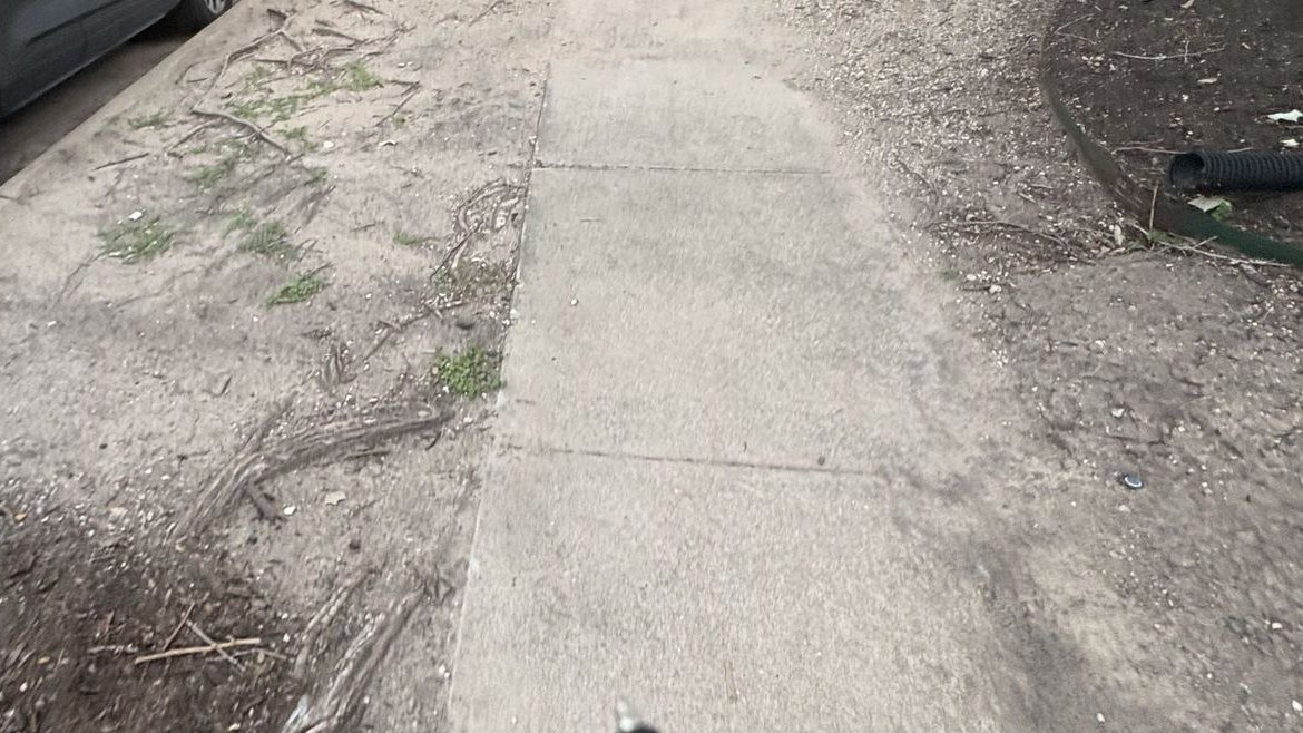
Both spots had grass along the curb in 2013. In 2026 the same ground is bare soil. A soil and irrigation survey would show why. See Schutze St in 2024 and 2026
2013 images © Google, Street View.
What it looks like
Photos neighbors took from the sidewalk. Swipe through them, and tap one to see it bigger.
This is still happening. The Tom Miller St photo below is from a newly built home. City records show its irrigation permit was issued in May 2026, one of at least ten the City issued in Section 11 this year.
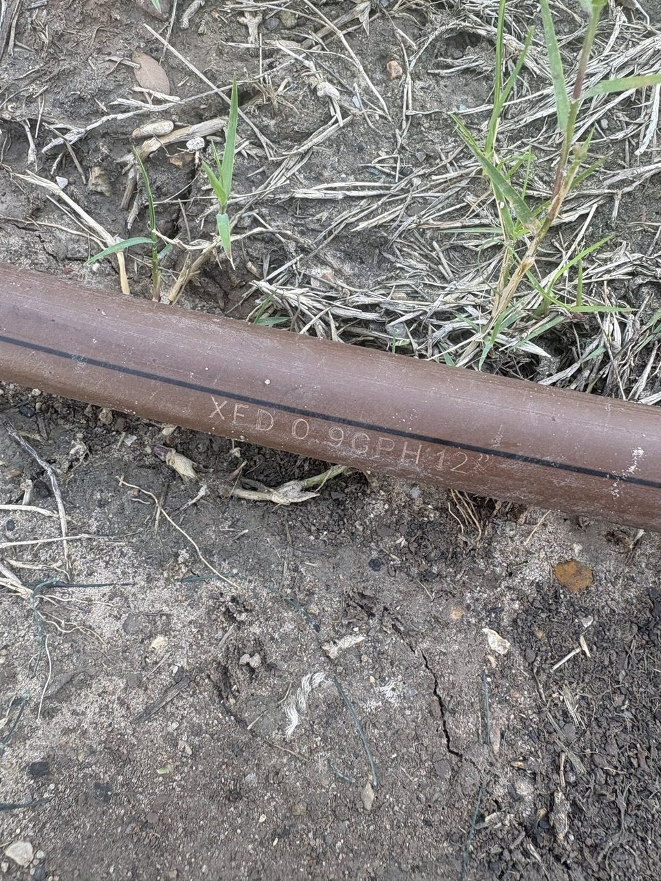
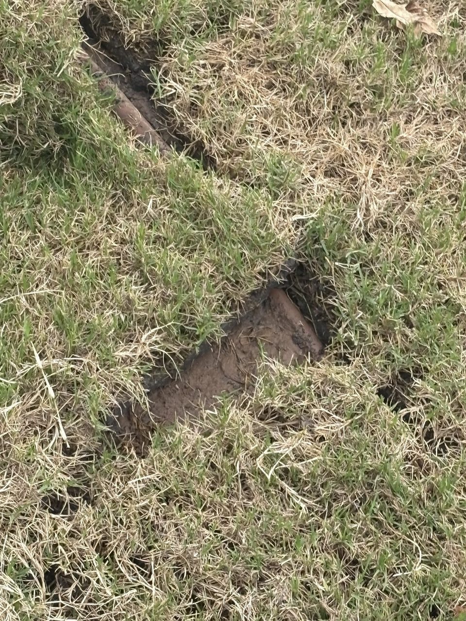
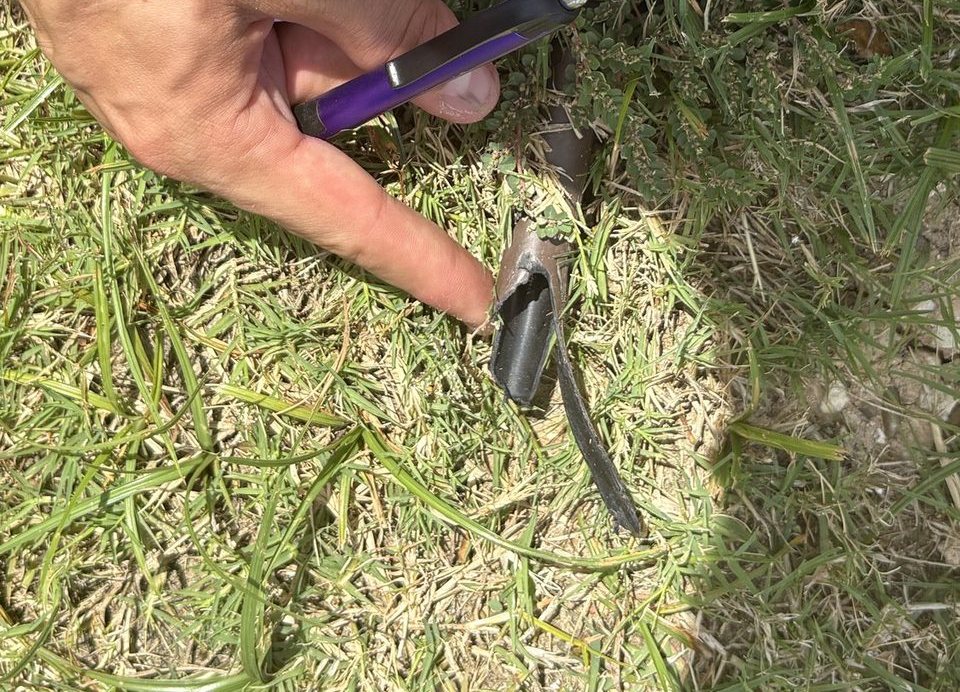
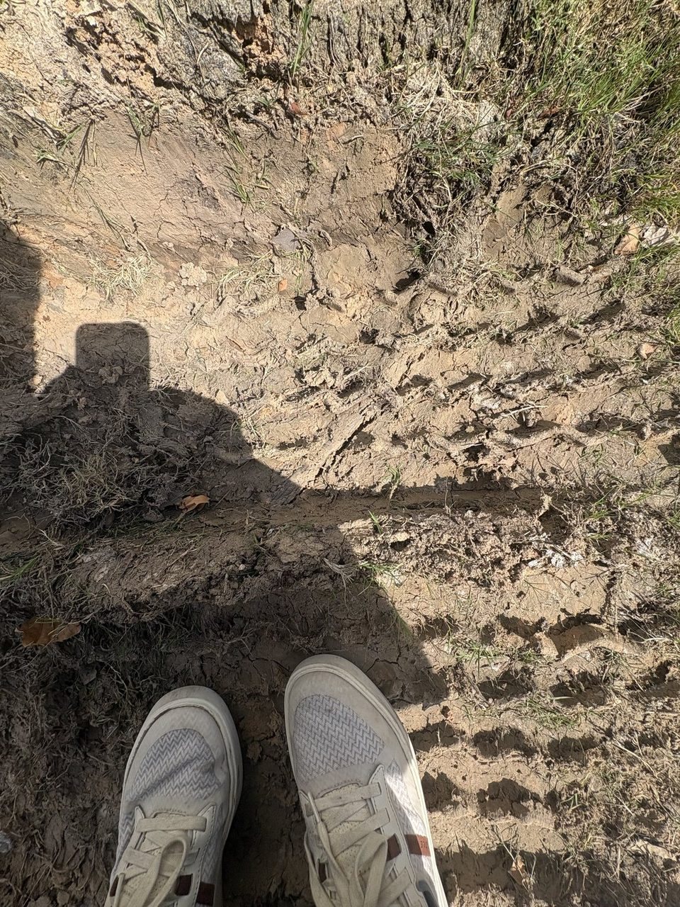
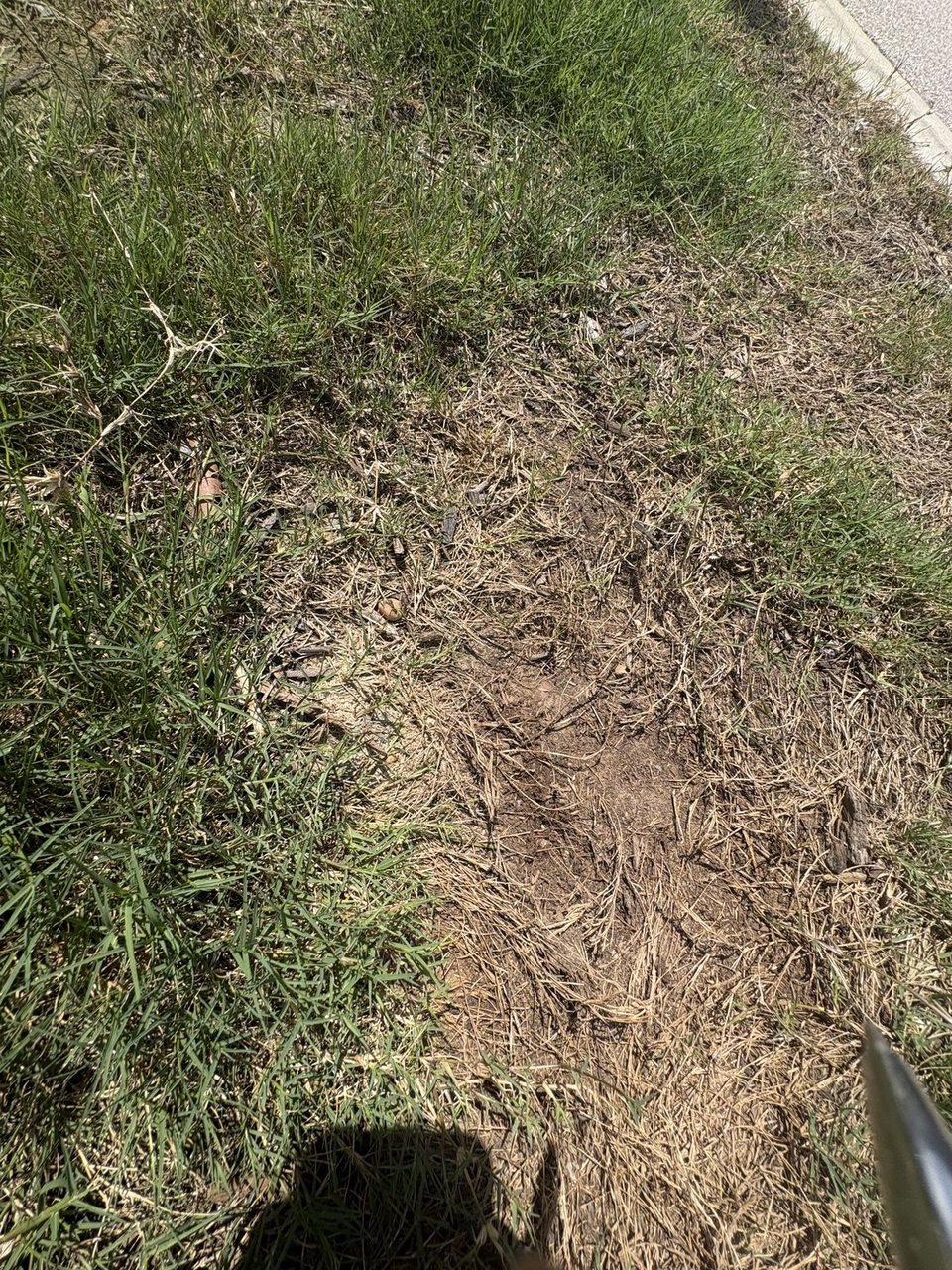
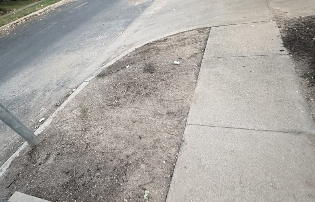
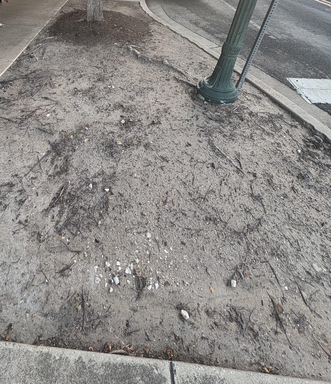
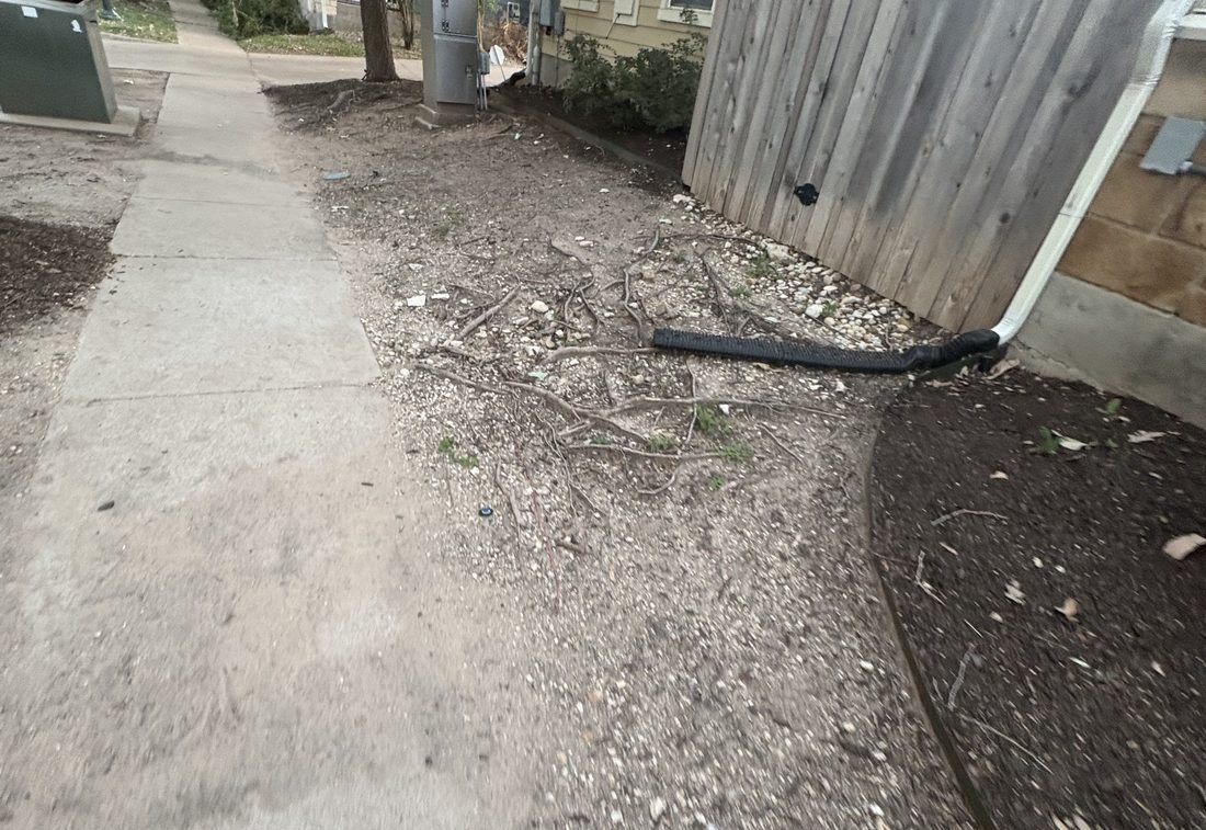
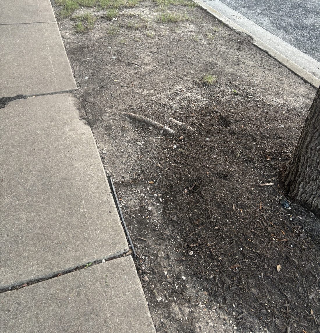
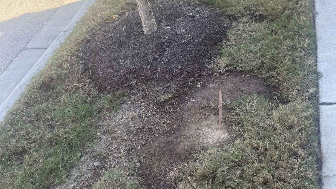
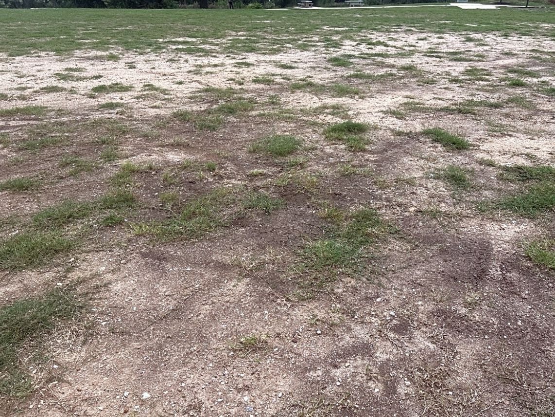
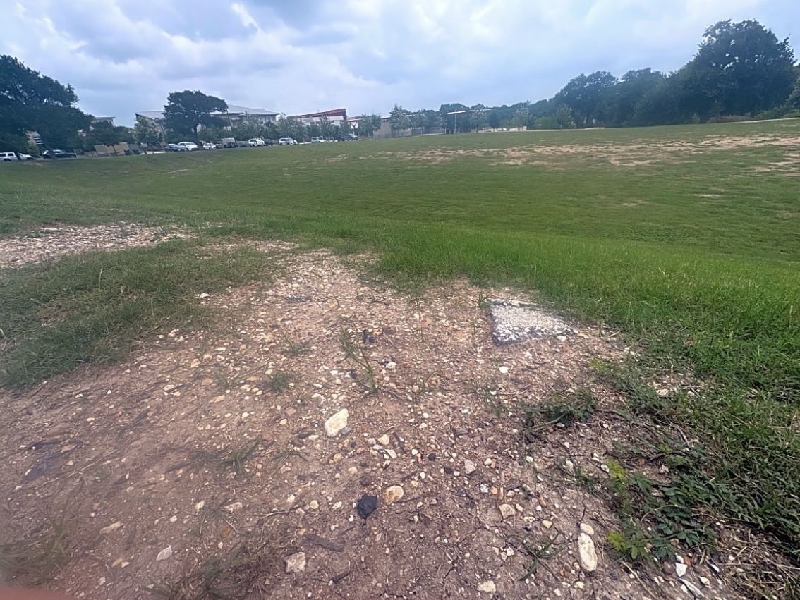
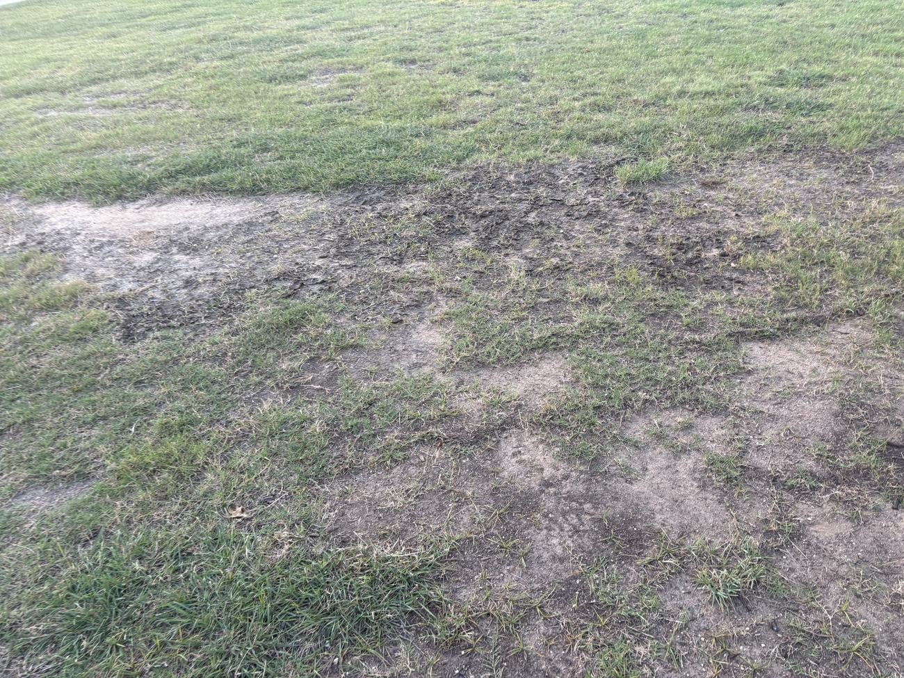
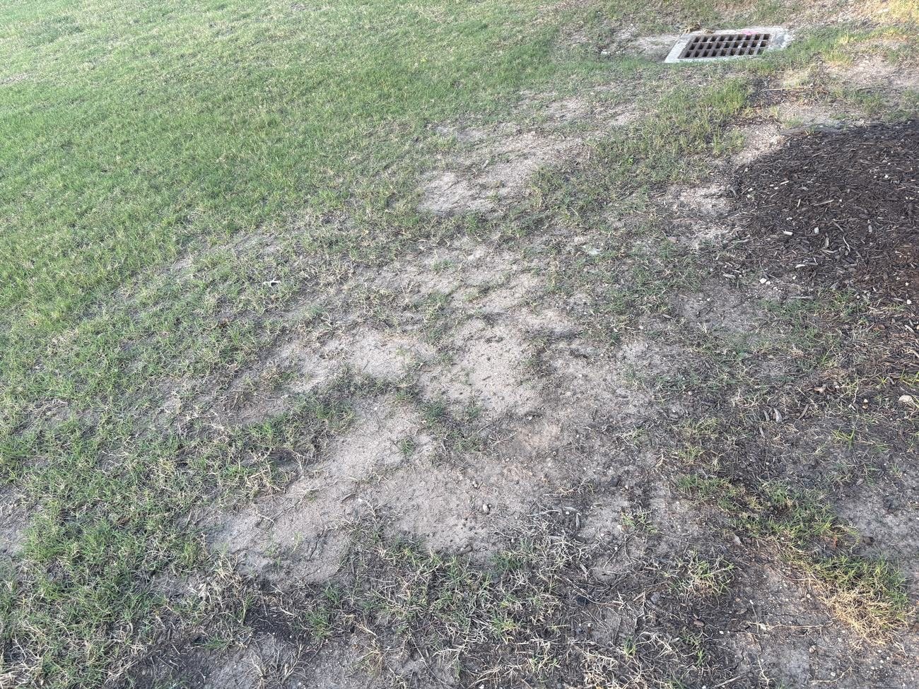
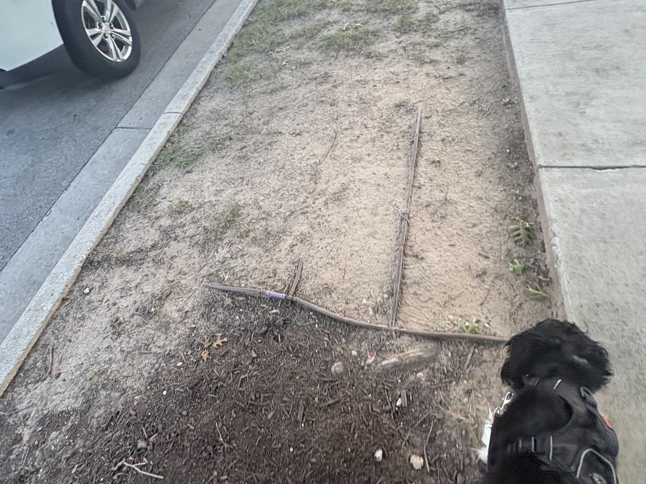
Zach Scott St and the parks were built years earlier, under other City-approved plans that we have not read yet. The photos show grass that is gone and soil that is bare. A soil and irrigation survey would show why.
The vote on closing Mueller's infrastructure fund
$58 millionof property tax collected in Mueller to pay for Mueller's infrastructure. City staff want to spend it on other things.
Since 2004, the growth in City property tax on homes and businesses in Mueller has gone into one fund, the Mueller Tax Increment Reinvestment Zone, to pay for public infrastructure here: roads, utilities and parks. City staff now say the job is done. Their memo to the Council says “all the major infrastructure projects at Mueller identified in the Project Plan have been completed and paid for.” They have asked the Council to close the fund on December 3. They project about $58 million left after the bonds are paid off. This is where they recommend it go:
- $25 milliona reserve for the City's 2028 budget
- $26 millionCity housing and homelessness programs
- $7 millionaffordable for-sale homes in Mueller
- $0Mueller's streets, landscaping, irrigation or parks
Street landscaping is infrastructure. The City's own agreement with the developer lists it as infrastructure the developer builds. The photos on this page show curb strips of bare clay and drip line lying on top of the ground. Nobody should call that complete until the City has inspected it against its own approved plans.
There is still time. The December 3 vote closes the fund. The spending list needs a second Council vote, so it can still change. The City's agreement with the developer ends on December 31, 2027, and the memo does not say who pays to fix the landscaping after that. It names Mandy DeMayo and Belinda Weaver at Austin Financial Services as the people to contact with concerns.
Council agendas can change, so check the City's posted agenda before relying on the date.
Email the City before December 3
Ask the City to inspect Mueller's street landscaping before it closes the infrastructure fund. The message is already written. Add your name and street, change anything you like, and send it from your own email.
These two boxes fill in the last lines of the message. What you type stays on your device and is not sent to this site.
- ToMandy.DeMayo@austintexas.gov
- CcBelinda.Weaver@austintexas.gov, poapresident@lifeatmueller.com
- SubjectMueller TIRZ closure on December 3: street landscaping at Mueller
If that button does nothing, your device has no mail app set up. Open it in Gmail or copy each part into a new email. The Cc line copies the other City contact and the Mueller POA President, so the Association sees what neighbors are sending.
Seen this on your block? Put it on the map.
The more blocks on the map, the harder this is to ignore. It takes about two minutes on your phone.
- Take a photoBare ground, clay showing, or drip line you can see.
- Tell us whereType the address, or tap the spot on the map.
- Check what's wrong and sendIrrigation, soil, or something else. Add a comment if you like.
We show the block, never your house number, name or email. A volunteer looks at every report before it goes up.
Open the full map to read the reports and filter by irrigation or soil. The dashed line is the outline of Mueller's homes.
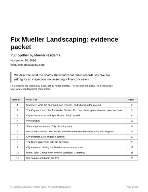
Read the evidence for yourself.
One PDF with what is behind this page: the City-approved plan sheets, the topsoil specification, the irrigation rules, the City's permit list, the recorded covenant and the photos. 28 pages, 5.5 MB.
Share it with a neighbor. Photos are located by block, not by house number.
What the plan says
The City approved a construction plan for Mueller Section 11 (plan No. C8-04-0043.10.1B.SH). Two notes on Sheet 003 cover the ground under the grass.
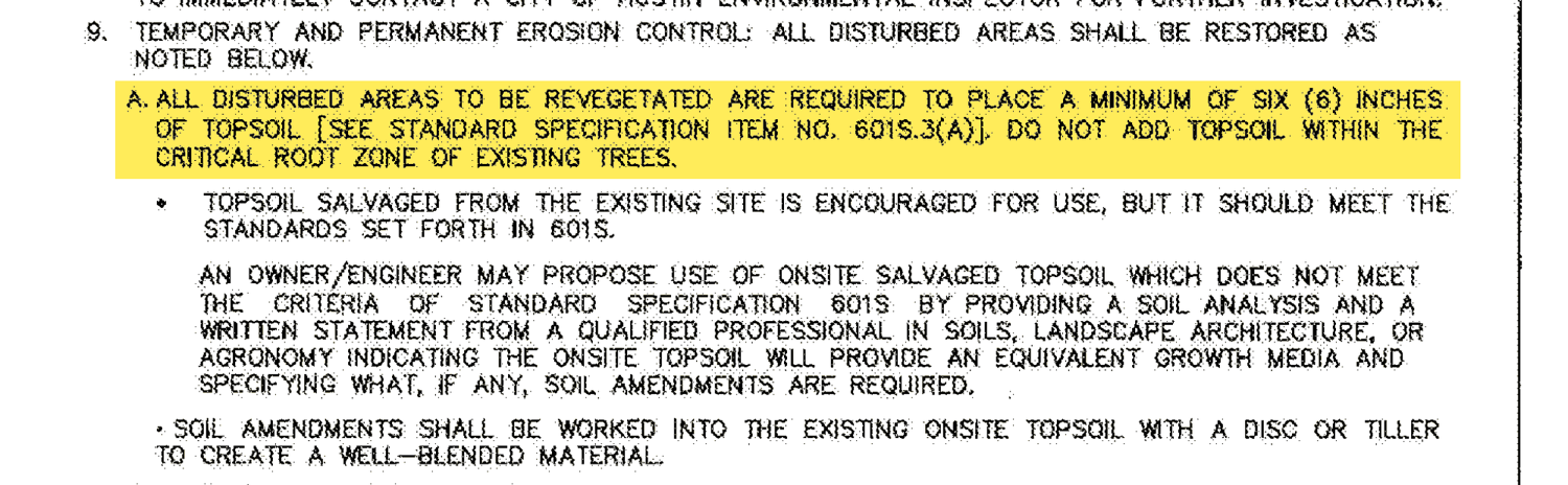
Scroll sideways to read the whole excerpt

Scroll sideways to read the whole excerpt
What the photos show
Where the ground is open, the sod and the drip line sit right on gray and tan clay. No dark topsoil layer shows in the photos. The strips on several streets have bare and dead patches, photographed in June and November 2026. We have not measured them yet.
The drip line has rules of its own
The plan covers the topsoil and the grass. The irrigation falls under the City's plumbing code and the state's irrigation rules.
The City's code says irrigation must follow the state rules. The state rule says pipe goes in at the depth its maker publishes, and the maker says 4 to 6 inches down. The photos show line at the surface. Thirteen of the 15 permits for Section 11's common-area irrigation expired without a final inspection.
Show the six steps, with the code sectionsHide the six steps
-
The City's plumbing code points to the state rules
“Irrigation for landscape must comply with the requirements in Chapter 344, Title 30 of the Texas Administrative Code; Sections 614.1 through 614.2 of this code; and requirements imposed by the Texas Commission on Environmental Quality.”City of Austin Ordinance No. 20210603-057, Section 614.0. This was the plumbing code in effect when the Section 11 irrigation permits were issued.

Scroll sideways to read the whole excerpt
-
The state rule says to follow the maker's depth
“Piping in all irrigation systems must be installed according to the manufacturer's published specifications for depth coverage of piping.”30 Texas Administrative Code §344.62(l)
-
The maker says 4 to 6 inches down
“XF Series Dripline is to be installed at a depth of 4"-6" (10.2-15.24 cm) in subsurface and groundcover applications. Use only XFS or XFS-CV dripline in subsurface applications.”Rain Bird, XF Series Dripline Design, Installation and Maintenance Guide
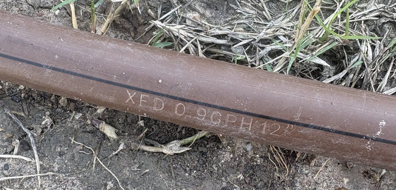
XFD is Rain Bird's on-surface line. The chart in Rain Bird's guide lists XFD for “On-Surface, Level Grade Installations” and lists only XFS and XFS-CV for turf grass. Putting XFD under grass does not appear to follow the manufacturer's published specifications.
The type of line varies from block to block, and XFD is confirmed only on the 3100 block of Sorin St, where the stamp could be read. Even the two types made for grass go 4 to 6 inches under the surface.
-
The photos show line at the surface
On several blocks, and along the street edge of John Gaines Park, the drip line is lying on top of the ground or right under the sod mat.
-
So it needs an inspection
From the photos, these lines do not appear to meet the state rule or the City code. Whether that is a violation is for the City's inspectors or the Texas Commission on Environmental Quality to decide. That's the inspection we're asking for.
-
Most of the permits never got a final inspection
“A plumbing permit must be obtained before installing a landscape irrigation or yard sprinkler system.”Ordinance No. 20210603-057, Section 104.1.4
The City issued 15 permits for common-area irrigation in Section 11. Thirteen expired without a final inspection and two were finaled, according to City permit records checked on November 15, 2026.
What the soil is like
One sample from the 3100 block of Schutze St, taken October 6, 2026, and what a home test kit read. The sample is pale, molds like modeling clay and fizzes in vinegar. The kit read it alkaline, with nitrogen and phosphorus at the bottom of its scale.
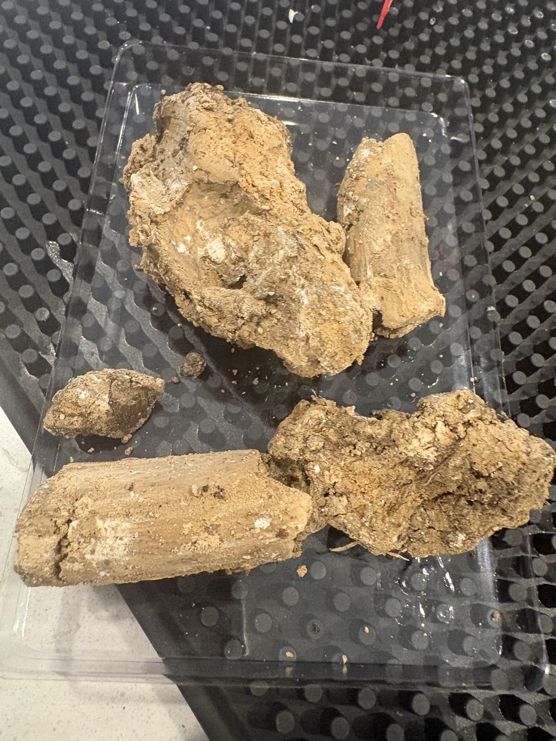
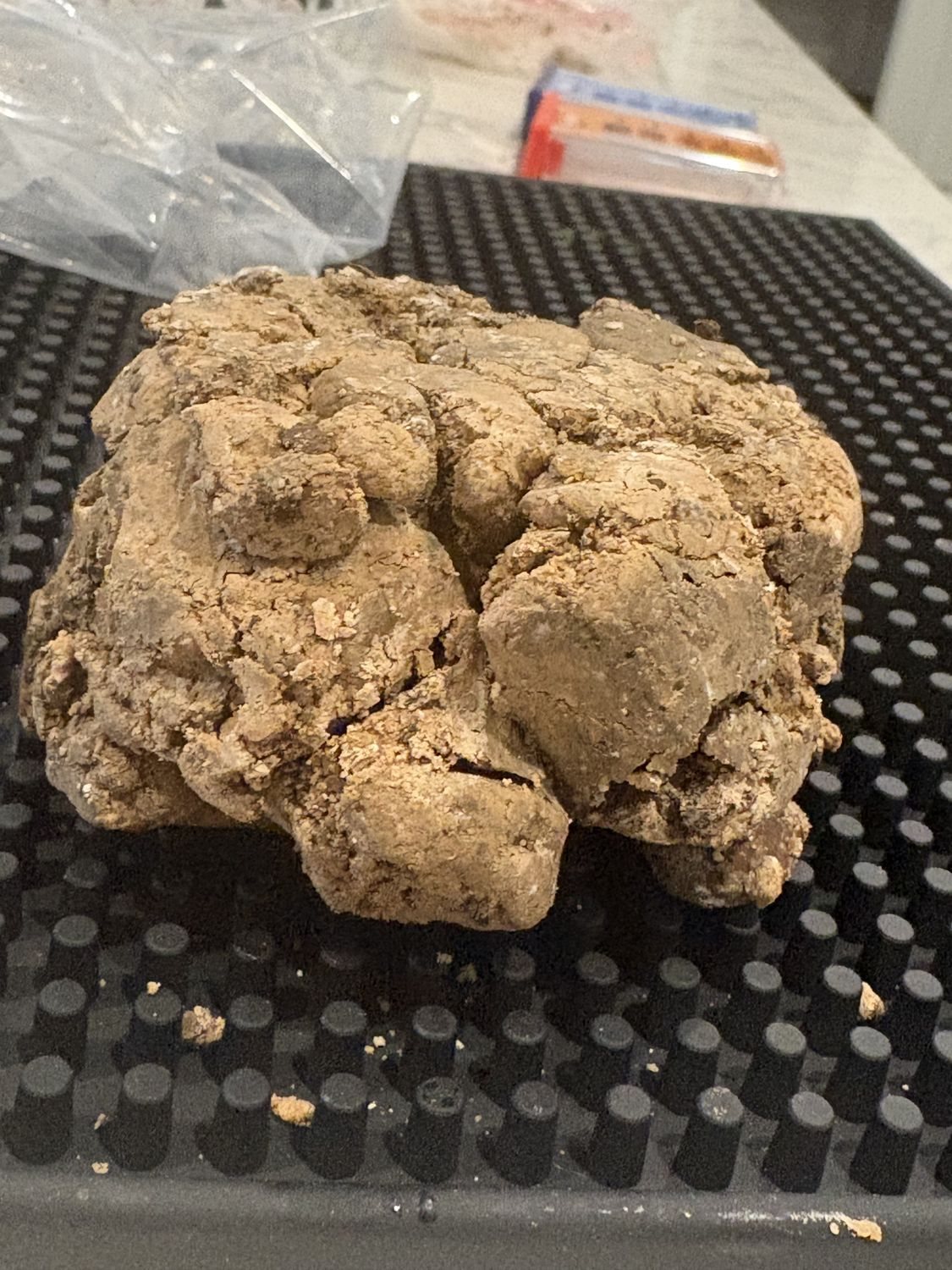
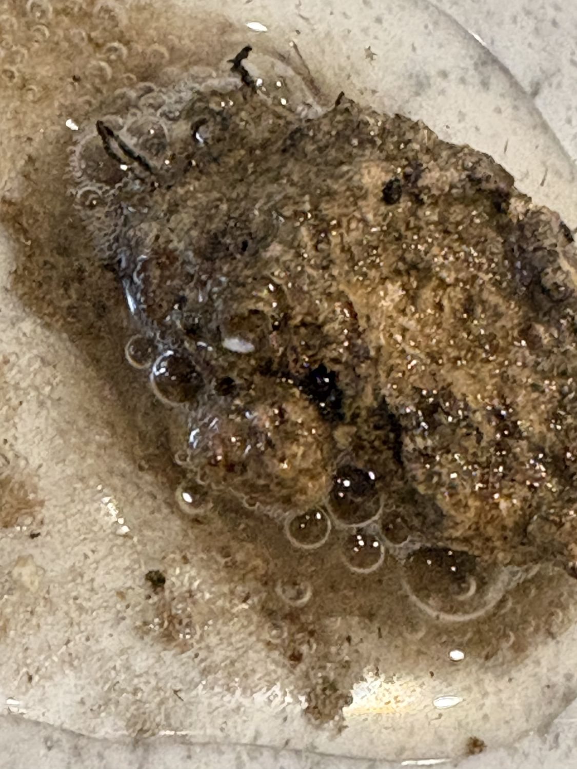
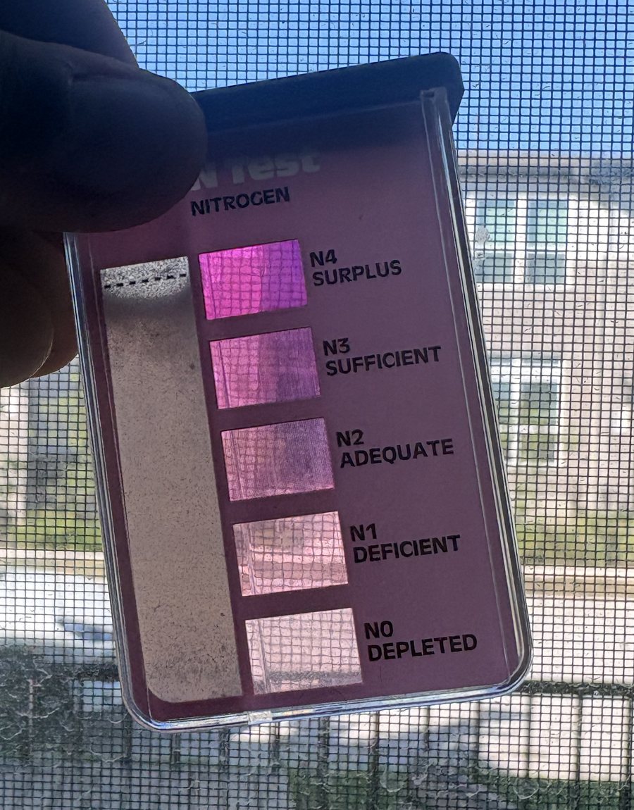
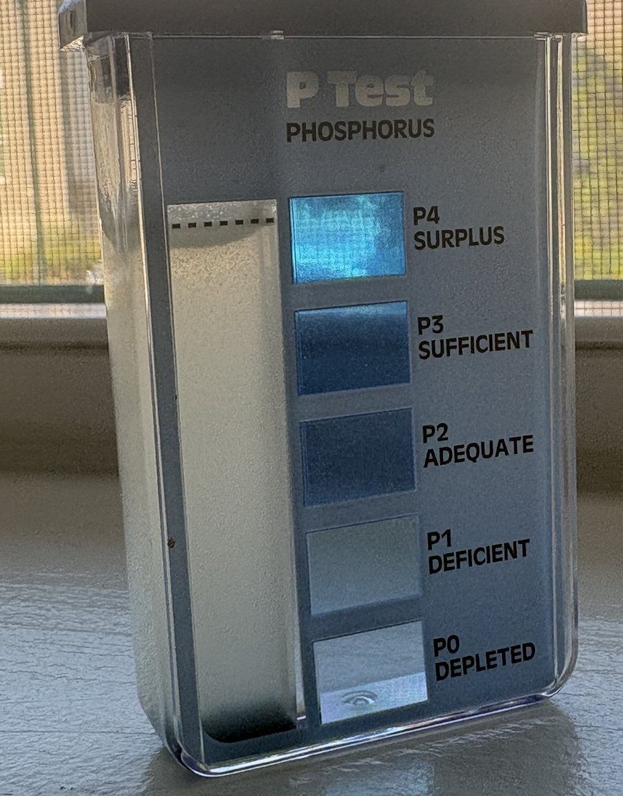
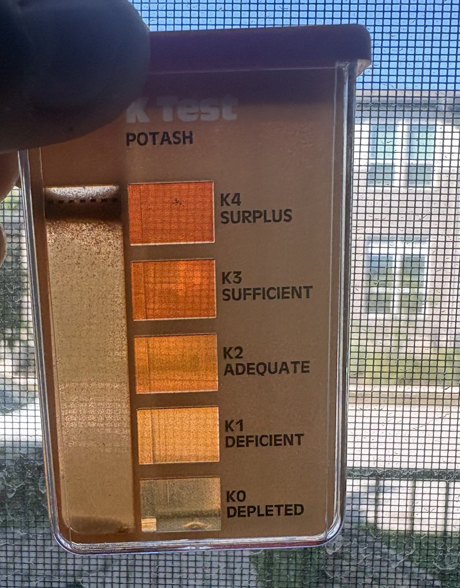
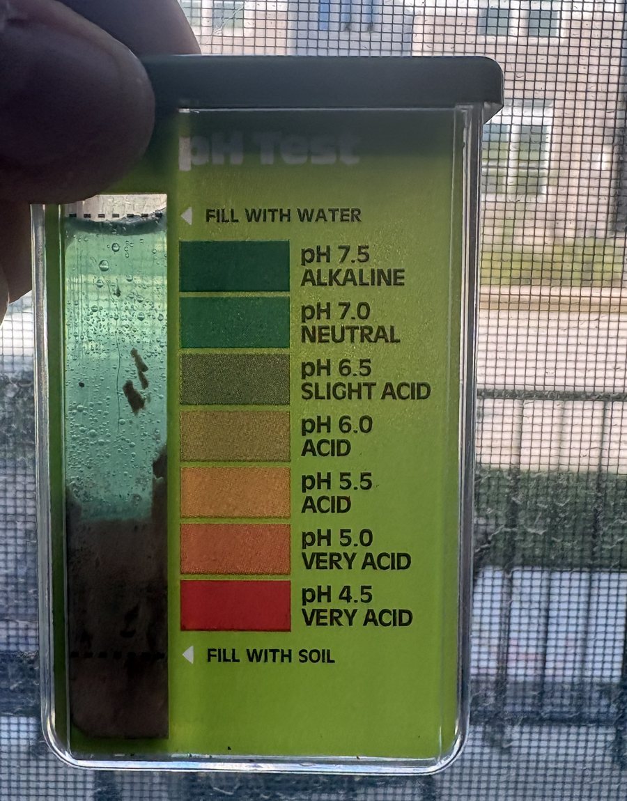
This is a home screening test on one sample, with the colors read by eye. A laboratory test would settle it.
Why would the soil read this way?
Topsoil is dark and crumbly because it holds decayed plant material. Soil stores nearly all of its nitrogen in that material, so ground with very little of it has little nitrogen to give.
The fizz in vinegar is acid reacting with lime. Lime keeps soil alkaline, and in alkaline, limy soil phosphorus binds with calcium into a form roots can't take up. The nutrient can be in the ground and still be out of reach.
Dense clay also has few air spaces. It swells shut when wet and sets hard when dry, so roots stay shallow, up in the sod layer, where they dry out quickly.
Who is responsible?
Here is what the documents say. It's part of what we're asking the City to sort out.
Show the developer, the home builders, the Association and the CityHide the four notes
The developer
Catellus Austin, LLC is the developer named on the approved plan. Its Master Development Agreement with the City lists street landscaping as infrastructure it builds, and Section 7.2(g) requires it to have its contractors correct defects and deficiencies.
The home builders
The recorded covenant (Section 2.18) put front-yard landscaping and an automatic irrigation system on each lot's owner before the certificate of occupancy. Before a home was sold, that owner was its builder.
The Association
For the row-house blocks it covers, the covenant gives the Mueller property owners' association “all aspects” of maintaining the landscaping and irrigation from the front of each home to the curb, including the strip along the street. Owners' assessments pay for that upkeep.
The City
The City approved the plan and issued the permits. We are asking it to inspect the work against the plan before the zone is closed.
What we're sure of, and what we're not
- We describe what the photos show and what public records say. We are asking for an inspection, not announcing a conclusion.
- The photos show the surface. They are not a soil survey, and the bare areas have not been measured.
- Not every street or yard has the problem. The map shows only what has been reported and reviewed.
- The plan and the permits quoted here are for Mueller Section 11. Older streets and the parks were built under other plans, which we have not read yet. Reports from anywhere in Mueller are welcome.